top of page

Bike Trails

and Bicycle Travel

Little Miami Trail Group of Bikers.jpg
TOP

Photos by Matt Bayman

TRAILS

Buck Creek Trail

6 Miles: Springfield to Buck Creek State Park 

   The trail starts at Veterans Park in downtown Springfield, where unusually large outcrops of limestone remind visitors that an ancient river helped carve out the modern landscape. It then passes an outdoor amphitheater and the Springfield Museum of Art before following Buck Creek to Old Reid Park (a fishing area) and then into the state park boundaries. At Buck Creek State Park, several more miles of trails lead to swimming, camping, fishing, hiking, boating and much more. 

DSC_6088.JPG
DSC_6099.JPG
Tecumseh at Springfield Art Museum Buck Creek Trail.jpg
DSC_6155.JPG
DSC_6152.JPG
DSC_6120.JPG
DSC_6145.JPG
DSC_6139.JPG
CREEKSIDE

Creekside Trail

15 Miles: Eastwood MetroPark (Dayton) to Xenia

   Creekside Trail connects Dayton with Xenia (and also the two largest trail systems in the network) and starts at Eastwood MetroPark. The first leg of the trip is very urban and passes a legal graffiti wall where artists have painted—and continue to paint—interesting scenes and images. The bike path follows the length of the wall before again returning to the countryside. It then passes a 9/11 memorial in Beavercreek.

DSC_6781.JPG
DSC_1044.JPG
DSC_6795.JPG
DSC_6807.JPG
DSC_6788.JPG
DSC_6811.JPG
DSC_1043.JPG
DSC_6799.JPG
DAY KETT

Dayton-Kettering Connector Trail

7.1 Miles: Iron Horse Trail on Wilmington Pike to RiverScape MetroPark 

   At this time, 1.9 miles of this trail is paved multi-use and 5.2 miles is shared roadway and bike lanes, including as it passes through the heart of downtown Dayton. So, if you're looking for an urban cycling experience, this is your trail. If not, it isn't!

Dayton Kettering Downtown Skyscraper.JPG
Dayton Kettering Trail 911 Memorial.JPG
DSC_1133.JPG
Dayton Kettering Trail Sign with James.JPG
Dayton Kettering Trail Tunnel.JPG
Dayton Kettering Colorful Buildings.JPG
DSC_1144.JPG
Dayton Kettering Splash Pad at RiverScape.JPG
Dayton Kettering Cassanos Historical Marker.JPG
Dayton Kettering Statue.JPG
GREAT LITTLE

Great Little Trail

7 Miles: Waterbury Ridge Lane in Centerville to Crains Run Park in Miamisburg

   The plan for this trail is to one day use it to connect the Great Miami Recreational Trail with the Little Miami Scenic Trail—hence its name. Starting in Centerville, the trail begins without fanfare, passing through a congested area next to Austin Landing. After this, however, it's pretty cool as the path drops down into the Miami Valley, eventually reaching the Great Miami River, and its bike trail.

DSC_7055.JPG
DSC_7029.JPG
DSC_7035.JPG
DSC_7050.JPG
DSC_7105.JPG
DSC_7087.JPG
GREAT MIAI

Great Miami Recreational Trail

​77 Miles: from Piqua to Middletown + 16 miles that includes segments in Shelby County and Hamilton

   The diversity of the Great Miami Recreational Trail is what makes it so fun to ride from start to finish. You'll pass through big cities and small towns filled with shops, diners and tourist attractions, through deep stretches of forest and along the river, through dozens of parks and so much more. 

Great Miami Recreational Trail Between Troy and Tipp in the FallSMALL.jpg
Hope Bridge.jpg
DSC_0016.JPG
Dayton Fountain.jpg
Dayton Cityscape.jpg
Sidney Canal Feeder Tunnel.JPG
James By the Mural.jpg
The Shake Shack.jpg
Carrillon Park.jpg
Hospital in Dayton.jpg
Dayton Scape with Pink Flowers.jpg
Dayton Scape of Water North Dayton.jpg
Troy Bike Trail Tressle Bridge.JPG
DSC_1127.JPG
Riverscape MetroPark Trail.jpg
Pink Flowers Next to the River Close.jpg
Treasure Island Reflection of Lighthouse from Great Miami Recreational Trail Bike Path Tro
Reflecting Farm.jpg
Great Miami Recreational Trail Bike Path Between Troy and Piqua.jpg
McCook Field.jpg
The Wright Seaplane.jpg
IRON HORSE

Iron Horse Trail

7 Miles: Linden Avenue (Creekside Trail) in Dayton to Iron Horse Park in Centerville  

   This is not one of the most exciting trails in the Miami Valley Trails system, but it does a few highlights along the way.

Iron Horse Trail Kettering.JPG
Iron Horse Signage.JPG
Iron Horse Historical Sign.JPG
Iron Horse Trail Bike Sign for Kettering.JPG
Iron Horse End-ish.JPG
Iron Horse Trail with Flags.JPG
LITTLE MIAM

Little Miami Scenic Trail 

78 Miles: from Springfield to near the Ohio River in Cincinnati

   The Little Miami Scenic Trail is often listed as one of the best bike paths in the United States, and it lives up to this recognition. Taking 2 or 3 days to complete, the trail passes through great towns like Yellow Springs, Waynesville and Loveland (where lodging and food are available), as well as through some of the most beautiful parts of the state.

Little Miami Covered Bridge Over Bikeway 1.JPG
Little Miami Trail State Park Sign.JPG
Little Miami Trail Yellow Springs Bike Building.JPG
Little Miami Trail End Restaurant.JPG
Little Miami Trail Loveland Business.JPG
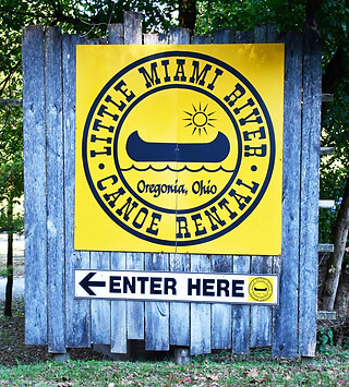
Little Miami Trail Canoe Rental.JPG
Little Miami Trail Tall Bridge.JPG
Little Miami Trail Caesares Creek.JPG
Little Miami Trail Beginning Woods.JPG
Little Miami Trail Purple Tunnel Near End.JPG
Little Miami Trail Fifty West Sign.JPG
Little Miami Trail Covered Bridge Nearby.JPG
Little Miami Trail Antioch Yellow Springs.JPG
Little Miami Trail Spring Valley Wildlife Area 2.JPG
Little Miami Trail Spring Valley Wildlife Area 1.JPG
MAD RIVER

Mad River Trail 

6.6 Miles: Deeds Point in Dayton to Huffman MetroPark  in Fairborn

   Starting at Deeds Point at the confluence of the Great Miami and Mad rivers and the nearby Stillwater River in downtown Dayton, the Mad River Trail follows the Mad River east to Huffman MetroPark. Here, it joins the Wright Brothers-Huffman Prairie Trail en route to Fairborn. 
   The trail is most notable because it follows a series of manmade lakes in Eastwood Park and then passes the National Museum of the U.S. Air Force. It also follows a section of Wright-Patterson Air Force Base, so expect to see a lot of barbed wire fences. 

BIcyclists at Deeds Point in Dayton.JPG
Statues of the Wright Brothers at Deeds Point in Dayton.JPG
Museum of the United States Air Force Best Shot.jpg
Mad River Air Force Museum.JPG
Mad River Trail Signage.JPG
Mad River Trail Brick Walls.JPG
Mad River Trail Next to River.JPG
Mad River Trail Bridge.JPG
Mad River Trail Eastwood Park Bridge 2.JPG
Mad River Trail Fence Tunnel.JPG
DSC_0540.JPG
OHIO ERIE

Ohio to Erie Trail 

​29 Miles: London to Xenia Station 

    If you enjoy a straight, mostly flat, yet scenic ride through farmland and charming little towns, the Ohio to Erie Trail is for you. There are hotels and campgrounds right on the trail!

Little Miami Trail Xenia Crossing.JPG
Little Miami Trail Red Train.JPG
DSC_6896.JPG
DSC_6836.JPG
DSC_6881.JPG
DSC_6877.JPG
DSC_6921.JPG
DSC_6847.JPG
DSC_6883.JPG
DSC_6889.JPG
DSC_6901.JPG
DSC_6843.JPG
OHIO IND

Ohio-to-Indiana Trail

21 Miles split between road and trail: 8 Miles paved trail from Troy-Sidney Road to Spiker Road in Piqua, plus the new section in Fletcher. Then a section in Gettysburg and three more segments in Greenville 

 Right now, the Ohio-to-Indiana Trail is the least-developed trail in the Miami Valley Trails network. It consists of seven segments, often separated by many miles on back country roads. However, it's a great trail with some great points of interest along the way, including passing through Greenville and Piqua.

DSC_6603.JPG
DSC_5158.JPG
DSC_6260.JPG
DSC_6622.JPG
Greenville Tecumseh Point Trail.JPG
Greenville City Park Peacock.jpg
DSC_6660.JPG
DSC_6656.JPG
Greenville City Park Fall 2.JPG
Shawnee Bike Path Greenville.jpg
DSC_6167.JPG
SIMON

Simon Kenton Trail

32 Miles: from Bellefontaine to Springfield

   If you’re looking for a relaxing, quiet and, yet, long bicycle ride through the flat countryside, the Simon Kenton Trail will be up your alley. Since this trail dead-ends into the Little Miami Scenic Trail, you can actually cycle more than 100 miles on what is probably one of the best one-two-punch trail combos in the country.

Simon Kenton Trail Art 2.JPG
Simon Kenton Trail Blue Bike.JPG
Simon Kenton Trail Springfield.JPG
Simon Kenton Trail Bridge Next to Railroad.JPG
Simon Kenton Trail Phone Pic Cool.jpg
Simon Kenton Trail Statue in Springfield.JPG
Simon Kenton Trail Phone Pic James Next to Train.jpg
Simon Kenton Trail Inn Sign.jpg
Simon Kenton Trail Downtown Springfield.JPG
Simon Kenton Trail Orange Bike.JPG
Cedar Bog Trail Beautiful.jpg
Cedar Bog Entrance with Historical Marker.jpg
Simon Kenton Trail Bridge.JPG
Simon Kenton Trail Urbana The Depot.JPG

Stillwater River Trail

STILLWATER
5 Miles: The south segment is from Island MetroPark in Dayton to Sinclair Park in Dayton. The north segment is from Grosnickle Park to Englewood MetroPark, both in Englewood

   Starting at Island MetroPark, and the confluence of the Great Miami and Stillwater rivers in Dayton, the southern segment of the trail passes Wegerzyn Gardens MetroPark and DeWeese Park before ending at Sinclair Park near Shoup Mill. 

Wegerzyn Gardens Dayton.JPG
DSC_5412.JPG
DSC_5414.JPG
DSC_5446.JPG
DSC_5438.JPG
WOLF

Wolf Creek Trail

​18.5 Miles: Verona to Great Miami Recreational Trail in west Dayton 

   The scenery along Wolf Creek Trail changes often, especially the different wildflowers that grow along the sides. Mostly, the trail passes through a combination of farmland and small towns, but it also visits Sycamore State Park (where camping is available), a bike park in Brookville and it ends at the Great Miami River near the Dayton Art Institute. The western side of the trail is very scenic.

Wolf Creek Trail Flowers 1.JPG
Wolf Creek Trail Brookville Train 1.JPG
Wolf Creek Trail Trotwood.JPG
Wolf Creek Trail Mural Trotwood.JPG
Wolf Creek Trail Woods.JPG
Wolf Creek Trail Missing Section in Troxwood - Copy.JPG
WRIGHT

Wright Brothers-Huffman Prairie Trail

15 Miles: Huffman MetroPark to downtown Fairborn

   This trail is highly unique because it hugs the boundary of Wright-Patterson Air Force Base and, in one section, actually goes on to the base. In fact, cyclists will be near the end of a long runway where massive cargo planes regularly take off. From the trail, the planes are so close that it feels like an earthquake is happening.
   What the trail lacks in beauty and tranquility, it makes up for with the attractions it provides access to. This includes the Wright Brothers Memorial (which contains a National Park Service interpretive center, Indian mounds and some of the best views in the Miami Valley), Huffman Prairie Flying Field (where the Wright Brothers perfected their early aircraft), Huffman MetroPark and dam, and downtown Fairborn, which is filled with interesting shops, including Halloween costume stores and toy and book shops.

DSC_0527.JPG
DSC_0520.JPG
DSC_5375.JPG
DSC_0534.JPG
DSC_0412.JPG
DSC_0409.JPG
DSC_0464.JPG
DSC_5387.JPG
DSC_5400.JPG
DSC_5392.JPG
XENIA

Xenia-Jamestown Connector 

17 Miles: Xenia to the Fayette County line

    This trail is for those looking for complete seclusion. For the easiest ride possible, start on the eastern end of the trail and head toward Xenia. It's all downhill!  

DSC_7010.JPG
DSC_6989.JPG
DSC_7006.JPG
DSC_6971.JPG
DSC_7021.JPG

Bike Travel

BIKE TRAVEL
bottom of page